Back to Blog
Geofencing Technology: Creating Virtual Security Perimeters
May 8, 2026
Springfield Overwatch Team
5 min read

Geofencing Technology: Creating Virtual Security Perimeters

Learn how geofencing with drone surveillance creates invisible security boundaries that detect unauthorized access and track movements.

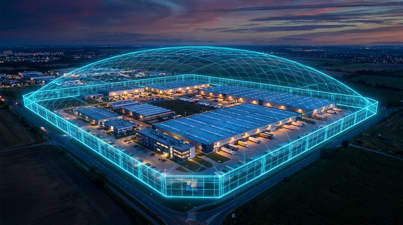
Physical fences protect property, but they have limitations. They require maintenance, can be cut or bypassed, and only mark visible boundaries. Geofencing technology creates invisible digital boundaries that provide superior threat detection.

When integrated with autonomous drone surveillance, geofencing creates a comprehensive perimeter security system that detects threats instantly.

What is Geofencing?

Geofencing uses GPS and wireless technology to create virtual boundaries around defined areas. When authorized or unauthorized entities enter or exit these boundaries, the system triggers defined actions.

A single property might have multiple geofences:

▸Perimeter fence: Entire property boundary
▸Critical zones: Equipment storage, livestock areas, facility entrances
▸Restricted areas: Off-limits locations due to hazards or security
▸VIP areas: Executive parking, offices, high-value asset storage

How Drone-Based Geofencing Works

1
Boundary Definition

Security managers define geofence boundaries on digital maps using GPS coordinates. Boundaries can be simple rectangles or complex polygons following actual property contours.

2
Real-Time Monitoring

Drones equipped with GPS and sensors continuously monitor their position relative to defined geofences. Additional sensors detect other vehicles, people, and objects.

3
Automated Alerts

When unauthorized entities approach or cross boundaries:

▸Instant alert to security team
▸Visual identification via drone camera
▸Recording of unauthorized activity
▸Automatic escalation procedures
4
Intelligent Response

The system can automatically:

▸Deploy drone for closer investigation
▸Activate perimeter lighting
▸Trigger alarm systems
▸Notify law enforcement (for critical breaches)
▸Lock access points

Key Geofencing Applications

Perimeter Security

▸Detect unauthorized vehicles or people approaching property
▸Alert to trespassers before they reach sensitive areas
▸Verify authorized visitors at gates
▸Track contractor and vendor vehicles
▸Prevent theft and unauthorized access

Critical Asset Protection

▸Create geofence around high-value equipment
▸Alert if equipment leaves property without authorization
▸Track maintenance and contractor access to equipment
▸Prevent equipment theft
▸Ensure only authorized personnel enter equipment areas

Livestock Protection

▸Geofence predator-prone areas
▸Detect when livestock wander beyond safe zones
▸Alert rancher to separated animals
▸Monitor access to water sources
▸Track grazing patterns

Vehicle Fleet Management

▸Create geofences around authorized parking areas
▸Alert if vehicles leave property or enter restricted zones
▸Track maintenance vehicle routes
▸Prevent unauthorized vehicle use
▸Optimize fleet deployment

Access Control

▸Verify vehicles and personnel at entrances
▸Prevent trespass by unauthorized vehicles
▸Track visitor access to different property zones
▸Enforce restricted access policies
▸Generate access audit trails

Measurable Benefits

Properties implementing drone-based geofencing achieve:

▸95% detection rate: for unauthorized access attempts
▸Instant alerts: (within seconds of boundary crossing)
▸Complete audit trail: of who accessed what areas
▸Reduced theft: by 80-85% for high-value equipment
▸Lower insurance costs: due to improved security documentation
▸Faster incident response: (drones reach incidents in seconds)
▸Flexible boundaries: (adjust without physical fence modifications)

Real-World Implementation

Case 1: Large Equipment Storage Facility

A contractor storage yard with $2M in equipment created geofences around high-value areas. When an unauthorized vehicle entered a restricted zone at 3 AM, the drone instantly deployed, captured identification, and security responded. The attempted theft was prevented.

Case 2: Livestock Ranch

A 800-acre ranch created geofences around grazing areas and water sources. AI detected when livestock wandered into predator-prone areas or when coyotes approached from the surrounding wilderness. Ranchers prevented 23 potential livestock losses in the first year.

Case 3: Commercial Property

A 50-acre logistics facility implemented geofencing for vehicle access. Unauthorized vehicles attempting to access the property are instantly detected and photographed. Theft incidents dropped 86% in the first year.

Implementation Best Practices

1
Comprehensive Mapping
▸Use detailed GPS and satellite imagery
▸Map all property boundaries and critical zones
▸Include buffer zones for early warning
▸Account for topography and obstacles
2
Tiered Alerting
▸Different alerts for different geofences
▸Escalation procedures based on severity
▸Notification to appropriate personnel
▸Integration with physical security systems
3
Regular Testing
▸Verify geofence accuracy
▸Test alert delivery and response
▸Conduct unauthorized access simulations
▸Update boundaries as needed
4
Data Management
▸Archive geofence events for analysis
▸Generate regular access reports
▸Identify patterns in unauthorized access
▸Use data to optimize security deployment

Privacy and Legal Considerations

While powerful, geofencing requires careful implementation:

▸Only monitor within property boundaries or authorized areas
▸Comply with local surveillance regulations
▸Post clear signage about monitoring
▸Implement strict data access controls
▸Regular privacy audits
▸Clear data retention policies

Combining Technologies

Geofencing is most effective combined with:

▸License plate recognition (identify vehicles)
▸Face recognition (identify unauthorized personnel)
▸Real-time threat detection (assess intent)
▸Incident response protocols (coordinated response)

The Future of Perimeter Security

Geofencing technology moves security from static physical barriers to dynamic digital boundaries. Properties gain the flexibility to adjust security posture instantly as needs change, the visibility to detect threats before they breach perimeter, and the speed to respond to incidents immediately.

For properties serious about comprehensive security, geofencing is becoming essential infrastructure.

Ready to Secure Your Property?

Discover how Springfield Overwatch's AI-powered drone surveillance can transform your security operations.